


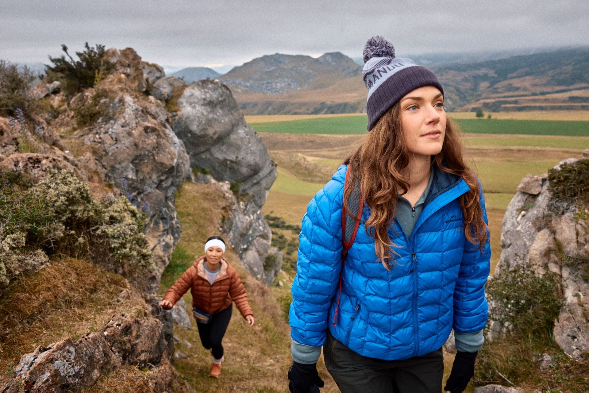

Top 10 Hikes in New Zealand's North Island
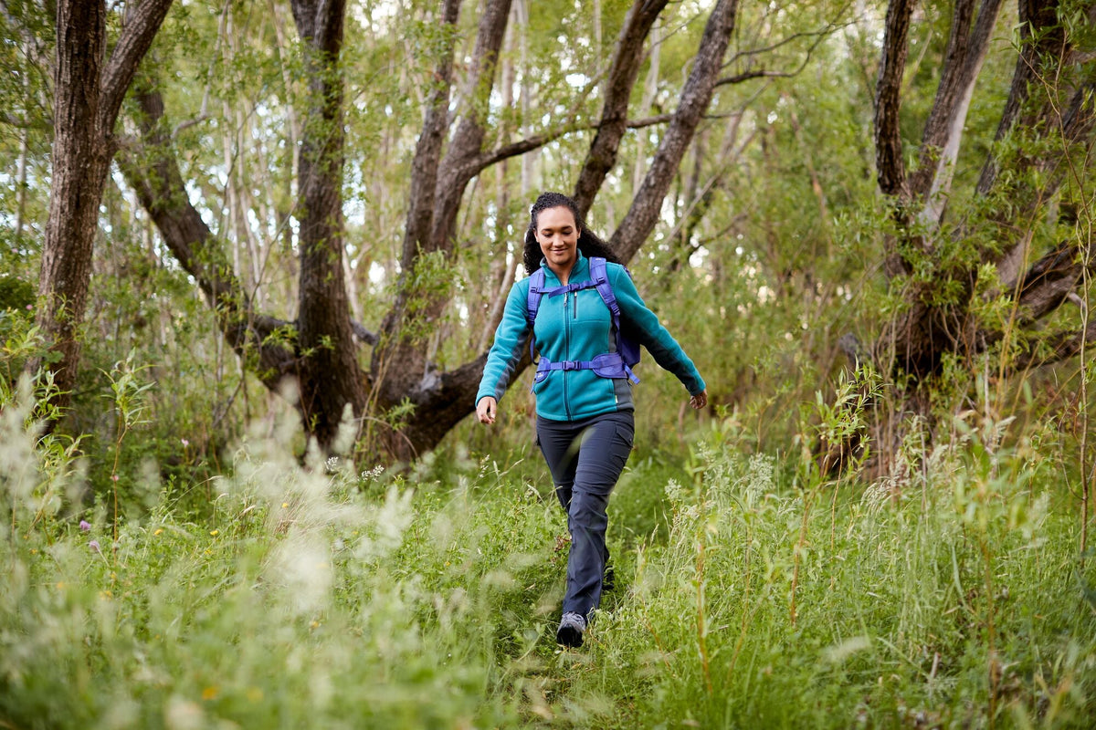
New Zealand’s North Island offers up day hikes through volcanic landscapes, sandy bays, and lush green forests — stuff dreams are made of! With day hikes that are perfect for just about every fitness level, there’s something out there for everyone. To help you plan your adventure, we’ve put together a list of our 10 most loved day hikes in New Zealand’s North Island.
Kathmandu partners with AllTrails, your digital trail guide and companion outdoors. The app helps you plan, live, and share your next adventure with over 420,000 curated trails across the globe. Out There Rewards(/out-there-rewards) members receive a free membership — learn more about the terms and conditions here(/out-there-rewards).
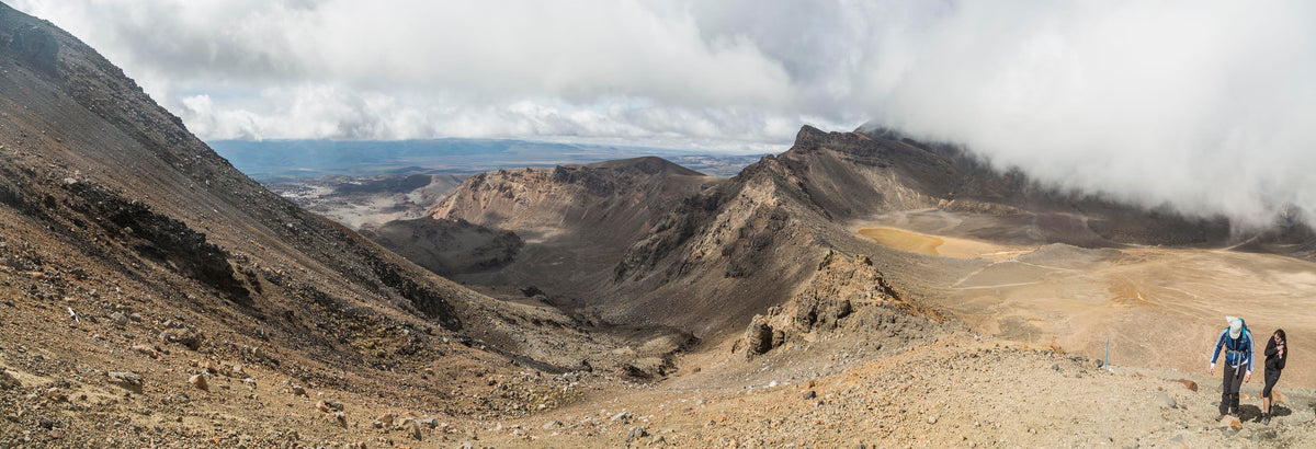
1. Tongariro Alpine Crossing, Tongariro National Park
- Duration: 7-8 hours
- Length: 19.4 km one way
- Elevation Gain: 1196 m
- Need to know: No dogs are allowed on the track. Seasonal parking restrictions are in place, bookings are recommended for all visitors and are necessary to use a shuttle or guided walk service.
Rain or shine, this walk is a must-see when it's your first time exploring the beautiful North Island of New Zealand, especially if you're a Lord of the Rings nerd.
Tie up your shoelaces, pack your day pack, slap on some sunscreen, and get out there. The track takes you past stunning volcanic alpine landscapes, crater lakes, and lush native forests.
Don't attempt this hike on your own in the winter months (unless you're experienced in alpine tracking and have the necessary equipment and skills) and DO NOT leave the main track for detours up sacred Mt Ngāuruhoe.
Read our full article here (/blog/tongariro-alpine-crossing)
2. Mount Maunganui Summit Track, Bay of Plenty
- Duration: 2 hours
- Length: 6.4 km loop
- Elevation Gain: 251 m
- Need to know: No dogs are allowed on the track.
A super popular hike (you'll see why at the top!), so be prepared to meet many hikers and runners along the path — especially in the early morning! A few different tracks lead to the summit, giving you a few varied attempts and offering great views across Tauranga and the bays.
3. Mount Taranaki Summit Track, Taranaki
- Duration: 8-10 hours return
- Length: 12.6 km return (via the same track)
- Elevation Gain: 1540 m
- Need to know: No dogs are allowed on the track. This is an advanced tramping track and should only be attempted in good weather conditions (conditions around the mountain can change quickly) by experienced hikers.
This demanding and challenging day hike will take you up the saddle to the summit of Mount Taranaki, a dormant volcano, at 2,518 m.
After passing Tahurangi Lodge the track follows a poled route through the rock-covered valley, up a series of steps, and onto the steep gravel slopes until you reach ‘The Lizard’. The Lizard is the rocky ridge and the last hurdle before you reach the crater. Be prepared to use your hands and do some climbing as you pass over the large rocks. From the crater, it’s a short final climb up to the summit.
For less experienced hikers, it's advised to climb between January and April, as there's generally less snow on the track. Though, please note there will likely be snow on the crater, which you'll pass before the final push to the summit.
4. Te Paki Coastal Track to Cape Reinga, Northland
- Duration: 4 hours one way
- Length: 21 km return (via the same track)
- Elevation Gain: 650 m
- Need to know: No dogs are allowed on the track. Check the tide schedule before crossing Te Paki Stream, as the depth can vary.
The Te Paki Coastal Track is a beautiful trail in the far north of New Zealand, leading to Cape Reinga, the northernmost tip of New Zealand. The trail provides a mix of coastal landscapes, dunes, and panoramic views of the Tasman Sea and the Pacific Ocean. The Te Paki Coastal Track is generally considered moderate in difficulty, but certain sections, especially those with soft sand, can be physically challenging.
5. Karioi Summit Track, Raglan
- Duration: 4-5 hours
- Length: 12 km return (via the same track)
- Elevation Gain: 640 m
- Need to know: No dogs are allowed on the track.
The Karioi Summit Track is a popular hiking trail located near Raglan. The track leads you to the summit of Mount Karioi, offering stunning panoramic views of the surrounding landscape, including the Tasman Sea.
The trail begins with a gradual ascent through native bush, and as you gain elevation, the forest gives way to more open terrain.
As you approach the summit, the trail becomes steeper, and navigating through rocky sections. The final stretch may involve some scrambling, adding an adventurous element to the hike. Once at the summit, you're rewarded with breathtaking views of the Raglan coastline and the Tasman Sea. Take some time to enjoy the scenery and, if the weather is clear, you might even catch a glimpse of Mount Taranaki in the distance.
6. Te Mata Peak, Hawke's Bay (from Te Mata Peak Rd Carpark)
- Duration: 1.5 hours
- Length: 9 km return (via the same track)
- Elevation Gain: 205 m
- Need to know: Dogs must be kept on leash. The track is easy and well-signposted with great views. There are options to start from two other carparks to shorten the hike to the summit.
Embark on an exhilarating journey from the Te Mata Peak Rd Carpark to the summit, where you'll be rewarded with fantastic views across Hawke's Bay! Begin your ascent amidst the native flora, the trail gently winding upward. The elevation gain is gradually rising to approximately 290 meters above sea level and is ideal for Ideal for enthusiastic hikers seeking a bit of challenge with rewarding views.
As the trail unfolds, catch your breath at strategically placed viewpoints, each unveiling more of Hawke's Bay's stunning landscapes. The track occasionally steepens, adding a touch of adventure without overwhelming the senses. At the summit, the panoramic reward is nothing short of majestic – a breathtaking 360-degree vista of coastal plains and rolling hills.
7. Gentle Annie and River Ridge Tracks Loop, Wairarapa
- Duration: 3-4 hours
- Length: 11.3 km loop track
- Elevation Gain: 509 m
- Need to know: Dogs must be kept on leash. A beautiful and popular trail year-round. Located in the Tararua Forest Park it's great for backpacking, camping and hiking. Access via Holdsworth Campsite.
The trail can get very muddy in some places and sturdy hiking boots are recommended.
Embark on a journey with the Gentle Annie and River Ridge Tracks Loop, cradled in the heart of lush North Island forests. Start at the Holdsworth Campsite going counterclockwise (River Ridge Track first) to avoid the steepest uphill's. As you walk through native bush enjoy plenty of birdlife on a mostly shaded path with some lovely viewpoints along the way.
8. Huka Falls to Aratiatia Dam, Taupō
- Duration: 3-4 hours return
- Length: 15 km return (via the same track)
- Elevation Gain: 290 m
- Need to know: Dogs are allowed on the track but must be under control at all times. Mountain Bikes also share the path.
The trail begins near the famous Huka Falls, where the Waikato River narrows and rushes through a spectacular gorge. From here, walkers embark on a journey along well-maintained paths that wind through native bush and open landscapes. A few times a day the gates of the dam are opened to release the full flow of the river.
Trust us — this is an impressive sight from a few lookout points that you don't want to miss! The track starts after the last viewing area over the falls and climbs steadily before dropping under the SH1 bridge, passing the Wairakei power station before reaching the dam.
9. Pouākai Crossing, Taranaki
- Duration: 8-10 hours
- Length: 19 km one way
- Elevation Gain: 894 m
- Need to know: No dogs are allowed on the track. Starting the track from Egmont NP Visitor Centre will result in less climbing. This track is a backcountry track and not as well maintained as other DOC walks.
Offering beautiful views of cliffs and waterfalls, this circuit is the short version of the popular 2–3 day Pouākai Circuit and winds its way around the lower slopes of Mt Taranaki.
This 19 km track traverses through an alpine environment, so prepare for a long day with the possibility of fast-changing weather conditions. From Pouākai Hut, the track gets busy with hikers walking from the Mangorei car park to the tarns to see the famous reflection of the mountain in the lake.
10. Kauaeranga Kauri Trail (Pinnacles Walk), Coromandel
- Duration: 3 hours (one way)
- Length: 12 km return (via the same track)
- Elevation Gain: 450 m
- Need to know: No dogs are allowed on the track. This walk can be done as a day walk or with an overnight stay at Pinnacles Hut or Dancing Camp Campsite (book in advance).
Take a walk across swing bridges, past waterfalls, and great views across the Tairua River until you arrive at the Pinnacles Hut. From here it’s a steep 1 km (40 min) side trip to the Pinnacles Summit offering some breathtaking views across the Coromandel coastline. There are many sidetracks around the campsite and hut to explore so turning this into an overnight hike could be great for any avid explorers.
Keep in mind that all trail conditions and amenities may change, so it's always a good idea to check for the latest information on the DOC website or DOC office close to the trailhead before embarking on your journey. Remember to wear appropriate hiking gear, carry enough water and snacks, and be prepared for changing weather conditions before embarking on a hike.
If you want to stay in any huts overnight check the DOC online booking site for availability and book in advance to avoid being turned around at the end of a long day's hike.
Related Articles
What to look for in a rain jacket
Looking for the perfect rain jacket but feeling a bit overwhelmed by all the options? No worries, we've got you covered! Check out our guide on how to choose the ideal rain jacket for you.
3 minute read
Hiking the Tongariro Alpine Crossing
Rain or shine this walk is a stunner and a must when it's your first time exploring the beautiful North Island of New Zealand. So, tie up your shoelaces, pack your day pack and get out there amongst the stunning volcanic alpine landscape.
4 minute read
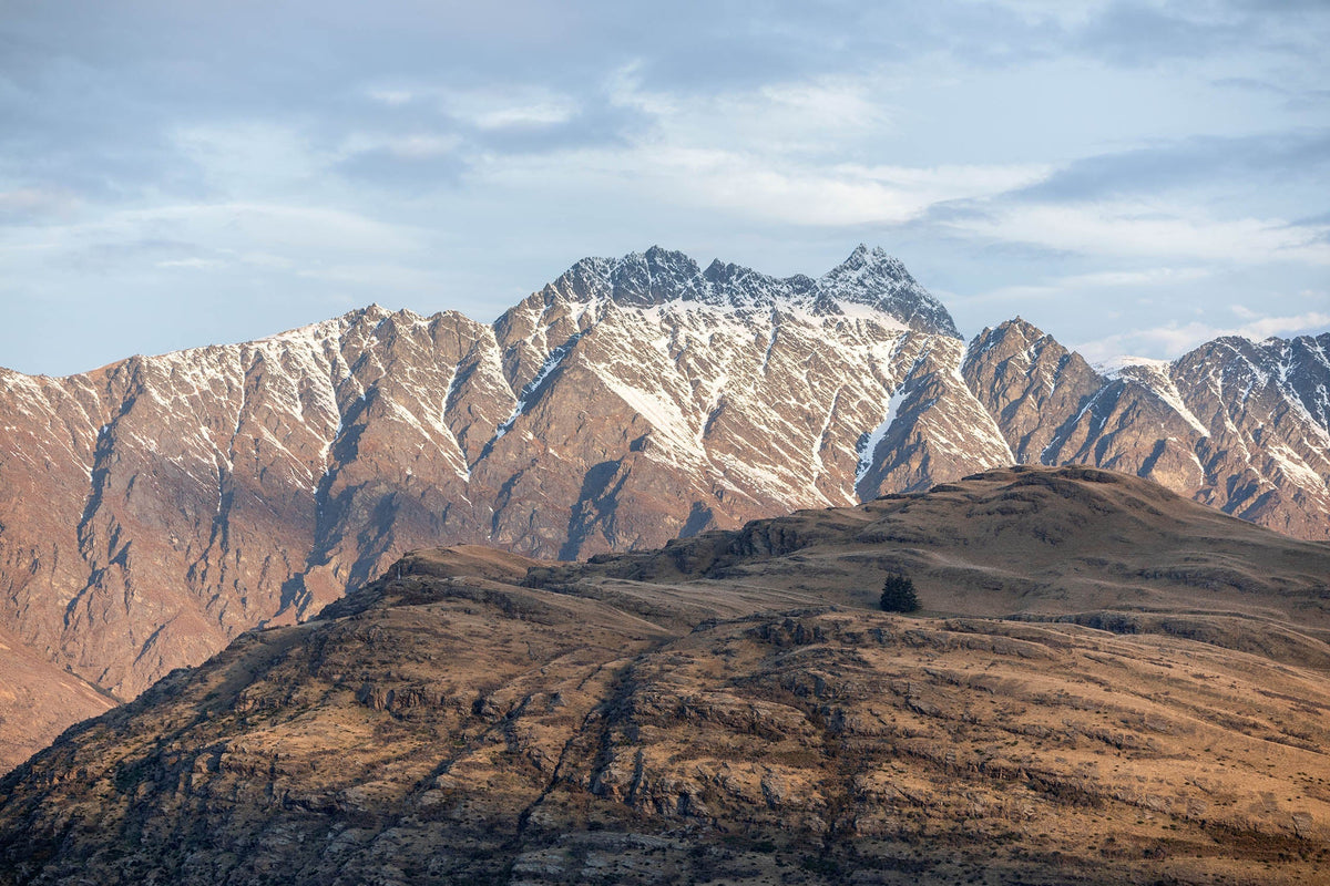
5 of the Best Day Hikes in Queenstown
Five of our favourite short hiking trails - perfect for a day's adventure in Queenstown.
2 minute read
What to Wear on a Spring Hike
Spring hiking is an exhilarating chance to make the most of fewer crowds, in-between temps, and stunning vistas. Unpredictable weather is a hallmark of spring, so we’ve created a guide to help you decide what to wear on a spring hike.
3 minute read
What to look for in a rain jacket
Looking for the perfect rain jacket but feeling a bit overwhelmed by all the options? No worries, we've got you covered! Check out our guide on how to choose the ideal rain jacket for you.
3 minute read
Hiking the Tongariro Alpine Crossing
Rain or shine this walk is a stunner and a must when it's your first time exploring the beautiful North Island of New Zealand. So, tie up your shoelaces, pack your day pack and get out there amongst the stunning volcanic alpine landscape.
4 minute read
5 of the Best Day Hikes in Queenstown
Five of our favourite short hiking trails - perfect for a day's adventure in Queenstown.
2 minute read
What to Wear on a Spring Hike
Spring hiking is an exhilarating chance to make the most of fewer crowds, in-between temps, and stunning vistas. Unpredictable weather is a hallmark of spring, so we’ve created a guide to help you decide what to wear on a spring hike.
3 minute read